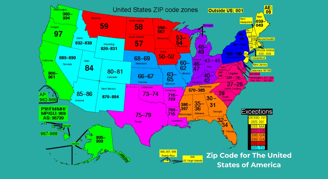
A ZIP code is a five-digit number that helps the U.S. Postal Service handle mail efficiently. The country has 41,704 ZIP codes, ranging from 00501 (Holtsville, NY) to 99950 (Ketchikan, AK).
To get additional information about the ZIP codes for the United States, locate the code along with the respective area or location on the table below:
Details
| Name | United States of America (USA) |
| Area Code | 201 – 989 |
| Calling Code | 1 |
| Capital | Washington, D.C. |
| ISO | US |
| Region | North America |
| ZIP Code | 00501 – 99950 (Five digits) |
United States of America ZIP Codes
| State | State Capital | ZIP Code | USPS |
|---|---|---|---|
| Alabama | Montgomery | 35004 – 36925 | AL |
| Alaska | Juneau | 99501 – 99950 | AK |
| Arizona | Phoenix | 85001 – 86556 | AZ |
| Arkansas | Little Rock | 71601 – 72959 | AR |
| California | Sacramento | 90001 – 96162 | CA |
| Colorado | Denver | 80001 – 81658 | CO |
| Connecticut | Hartford | 06001 – 06928 | CT |
| Delaware | Dover | 19701 – 19980 | DE |
| Florida | Tallahassee | 32003 – 34997 | FL |
| Georgia | Atlanta | 30002 – 39901 | GA |
| Hawaii | Honolulu | 96701 – 96898 | HI |
| Idaho | Boise | 83201 – 83877 | ID |
| Illinois | Springfield | 60001 – 62999 | IL |
| Indiana | Indianapolis | 46001 – 47997 | IN |
| Iowa | Des Moines | 50001 – 52809 | IA |
| Kansas | Topeka | 66002 – 67954 | KS |
| Kentucky | Frankfort | 40003 – 42788 | KY |
| Louisiana | Baton Rouge | 70001 – 71497 | LA |
| Maine | Augusta | 03901 – 04992 | ME |
| Maryland | Annapolis | 20588 – 21930 | MD |
| Massachusetts | Boston | 01001 – 05544 | MA |
| Michigan | Lansing | 48001 – 49971 | MI |
| Minnesota | Saint Paul | 55001 – 56763 | MN |
| Mississippi | Jackson | 38601 – 39776 | MS |
| Missouri | Jefferson City | 63001 – 65899 | MO |
| Montana | Helena | 59001 – 59937 | MT |
| Nebraska | Lincoln | 68001 – 69367 | NE |
| Nevada | Carson City | 88901 – 89883 | NV |
| New Hampshire | Concord | 03031 – 03897 | NH |
| New Jersey | Trenton | 07001 – 08989 | NJ |
| New Mexico | Santa Fe | 87001 – 88439 | NM |
| New York | Albany | 00501 – 14925 | NY |
| North Carolina | Raleigh | 27006 – 28909 | NC |
| North Dakota | Bismarck | 58001 – 58856 | ND |
| Ohio | Columbus | 43001 – 45999 | OH |
| Oklahoma | Oklahoma City | 73001 – 74966 | OK |
| Oregon | Salem | 97001 – 97920 | OR |
| Pennsylvania | Harrisburg | 15001 – 19640 | PA |
| Rhode Island | Providence | 02801 – 02940 | RI |
| South Carolina | Columbia | 29001 – 29945 | SC |
| South Dakota | Pierre | 57001 – 57799 | SD |
| Tennessee | Nashville | 37010 – 38589 | TN |
| Texas | Austin | 73301 – 88595 | TX |
| Utah | Salt Lake City | 84001 – 84791 | UT |
| Vermont | Montpelier | 05001 – 05907 | VT |
| Virginia | Richmond | 20101 – 24658 | VA |
| Washington | Olympia | 98001 – 99403 | WA |
| West Virginia | Charleston | 24701 – 26886 | WV |
| Wisconsin | Madison | 53001 – 54990 | WI |
| Wyoming | Cheyenne | 82001 – 83414 | WY |
Remember that ZIP codes aren’t like city or country codes; they’re specific to the U.S. and the Philippines. Other countries usually use the more general term “postal code” for sorting mail.
5 Digit United States of America ZIP Codes
A standard U.S. ZIP code is indeed a five-digit combination of numbers. It consists of five digits that help identify specific geographic areas or delivery zones within the United States.
However, there is also an extended version called ZIP + 4, where an additional four digits are added to the standard five-digit ZIP code. This extended format provides even more precise information about the delivery location, such as a particular street or block within the broader ZIP code area.
How Many 5 Digit ZIP Codes Are Possible?
The United States uses a five-digit ZIP code system, and each digit can take on values from 0 to 9. Therefore, for each position in the ZIP code, there are 10 possible digits (0 through 9).
Since there are five positions in a standard ZIP code, the total number of possible 5-digit ZIP codes is calculated as follows:
10×10×10×10×10=100,000.
So, there are 100,000 possible 5-digit ZIP codes in the United States.
Is ZIP Code for City or Country?
A ZIP code in the United States is primarily used for the sorting and delivery of mail within the country. It is not directly tied to a specific city or county in the sense that a single ZIP code may cover multiple cities, towns, or areas within a region. Instead, ZIP codes are designed to facilitate efficient mail processing by the United States Postal Service (USPS).
ZIP codes do not necessarily correspond to political or administrative boundaries like city or county lines. ZIP codes are assigned based on the volume of mail and the geographic location of post offices; they are tools for mail sorting and distribution rather than a strict indicator of city or county limits.
Are all US ZIP Codes Numeric
No, not all U.S. ZIP codes are numeric. While most ZIP codes in the United States are composed of five digits, there are also extended versions that include a hyphen and four additional digits, making them nine digits in total. These extended codes are often referred to as ZIP+4 codes.
For example:
Standard ZIP Code: 12345
ZIP+4 Code: 12345-6789
It’s important to note that the first five digits generally represent a specific area or region, while the additional four digits in the ZIP+4 code provide more precise location information, such as a particular building or office within that area.
11111 is not a valid ZIP code in the United States. ZIP Codes starting with “111” are associated with locations in New York, but “11111” is not a valid code within that range.
Other Frequently Searched US ZIP Codes
Zip Code USA New York
The ZIP Code for USA New York by city is 00501 to 14925 while the area code is 201 and 917. New York is one of the states in the United States, it can also refer to the city of New York> It is the largest city in the state and one of the most populous cities in the world.
The state of New York is located in the northeastern part of the United States, bordered by Vermont, Massachusetts, Connecticut, New Jersey, and Pennsylvania.
ZIP Code USA California
The ZIP Codes in California span from 90001 to 96162. California is a state located on the west coast of the United States. It is the most populous state in the country and is known for its diverse geography, ranging from coastal areas along the Pacific Ocean to mountainous regions and deserts. The state is home to major cities such as Los Angeles, San Francisco, San Diego, and the capital city, Sacramento.
US ZIP Code Texas
The ZIP Codes in Texas range from 73301 to 88595, area code is 210 – 979. This state is located in the southern part of the United States. It is the second-largest state in terms of both area and population.
Texas is bordered by Arkansas to the northeast, Louisiana to the east, Oklahoma to the north, New Mexico to the west, and the Mexican states of Chihuahua, Coahuila, Nuevo León, and Tamaulipas to the southwest. To the south, Texas has a coastline along the Gulf of Mexico. The capital of Texas is Austin, and its largest city is Houston.
ZIP Code for United States Georgia
The ZIP Code for Georgia by county and city ranges from 30002 to 39901, and the area codes are 229 and 912. The state of Georgia is located in the southeastern part of the United States.
This state is bordered by Florida to the south, Alabama to the west, Tennessee and North Carolina to the north, and South Carolina to the northeast. The capital and largest city of Georgia is Atlanta.